
Ondal Tourist Area (온달관광지)
0m 0 2024-02-26
23, Ondal-ro, Yeongchun-myeon, Danyang-gun, Chungcheongbuk-do
Ondal Tourist Area is the site of a battle between Goguryeo and Silla in the 6th Century over the control of the Hangang River. It is home to Ondal Exhibition Hall, the Ondal Open Film Set, Ondalsanseong Fortress, and Ondaldonggul Cave, inspired by the story of Goguryeo general Ondal and Princess Pyeonggang. Many Korean historical shows have been filmed in the Ondal Open Film Set. Ondaldonggul Cave was formed by the dissolution of limestone created during the Paleozoic period.
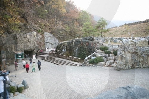
Danyang Ondaldonggul Cave (단양 온달동굴)
950.5679919278568m 42133 2020-01-02
23, Ondal-ro, Yeongchun-myeon, Danyang-gun, Chungcheongbuk-do
+82-43-423-8820
Ondaldonggul Cave is located underground at the foot of Seongsan Mountain, where Ondalsanseong Fortress is situated. It is a natural limestone cave that is estimated to have begun forming around 450 million years ago. The total 760 meter-long cave covers an area of 349,485 square meters. The cave mouth is two meters high, while the cave itself is 5 to 10 meters high and about 5 meters wide. The cave features stairway structure and contains an abundance of beautiful stalagmites and stalactites. The average temperature of the cave maintains 14 degrees Celsius in summer and 16 degrees Celsius in winter, making it a perfect all-year-round attraction. The cave is rich in underground water resources and there is a 0.8 to 1 meter-deep cave river flowing at the bottom of the cave floor. The cave also has over 40 small ponds that are inhabited by a variety of living organisms like fish and insects.
Situated on top of the mountain peak to the left of the cave is Ondalsanseong Fortress. The fortress has been preserved in its original form throughout some 1,400 years and shows the advanced building skills of Goguryeo Era (37 BC-668 AD). The annual Ondal Culture Festival is held every October around Ondaldonggul Cave and Ondalsanseong Fortress in memory of the legendary love story between General Ondal and Princess Pyeonggang. Other attractions in the area include a theme park and Jangseung (Korean traditional totem poles) Park.
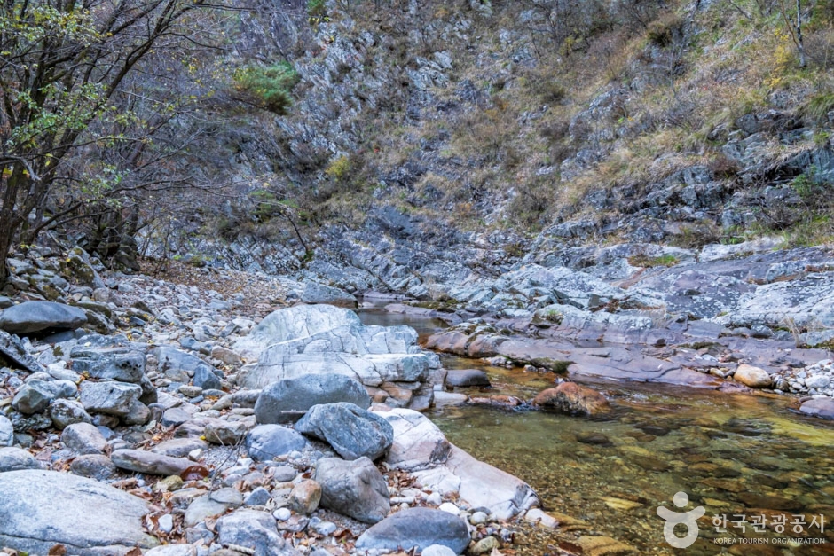
Namcheongyegok Valley (남천계곡)
2.8 Km 47543 2024-02-26
375, Namcheongyegok-ro, Yeongchun-myeon, Danyang-gun, Chungcheongbuk-do
Namcheongyegok Valley is located on the northern side of Sobaeksan National Park. The forest is preserved quite well because the valley is located deep within the mountain. Freshwater fishes can be found within the clear water of the valley. The lush plants and clear water in summer and the fall foliage in autumn present a beautiful view. Follow the small trails to find the Namcheon Campground, where one can enjoy camping deep in the forest.
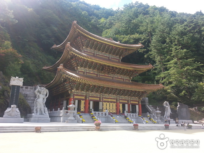
Guinsa Temple (Danyang) (구인사(단양))
3.5 Km 47661 2024-03-15
73 Guinsa-gil, Yeongchun-myeon, Danyang-gun, Chungcheongbuk-do
+82-43-423-7100
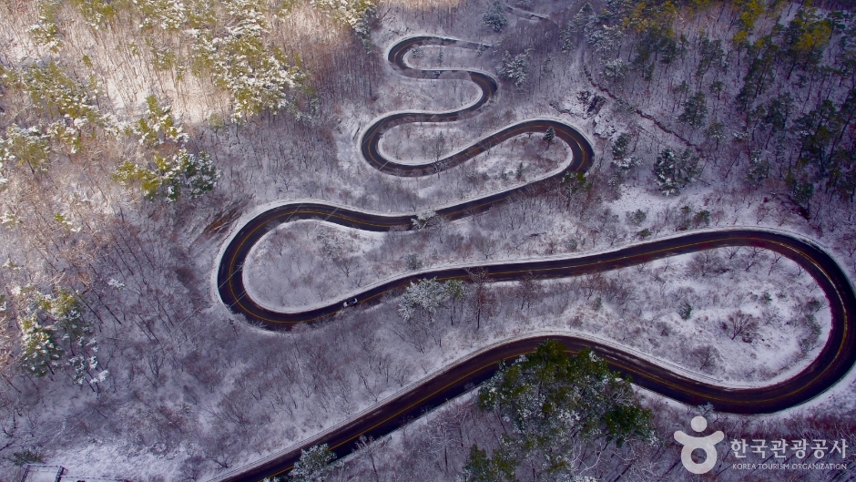
Danyang Bobaljae Pass (단양 보발재)
3.5 Km 0 2024-02-26
San 26-7, Baekja-ri, Yeongchun-myeon, Danyang-gun, Chungcheongbuk-do
Bobaljae Pass is located 540 m above sea level on the northern side of Sobaeksan Mountain. It is also known as Godeuneomijae Pass. The S-shaped curve is known for wildflowers in spring and fall foliage in autumn, so one can either take a leisurely drive along the road or park one’s car at the observatory and get some pictures. Guinsa Temple and Ondal Tourist Area nearby are also good to visit.
![Gossigul Cave [National Geopark] (고씨굴-강원고생대 국가지질공원)](http://tong.visitkorea.or.kr/cms/resource/85/483785_image2_1.jpg)
Gossigul Cave [National Geopark] (고씨굴-강원고생대 국가지질공원)
8.4 Km 9898 2021-08-23
1117, Yeongwoldong-ro, Yeongwol-gun, Gangwon-do
+82-33-560-2379
Gossigul Cave was designated as a Natural Monument on June 4, 1969, getting protection from the government for its educational and natural values. In 1974, the cave was opened to the public. The cave has various levels with underground water flowing on the bottom level. The cave is mostly made of limestone with various microorganisms inhabiting within.
Kim Satgat Historic Site (난고 김삿갓 유적지)
10.0 Km 30943 2024-02-16
216-22 Gimsatgat-ro, Gimsatgat-myeon, Yeongwol-gun, Gangwon-do
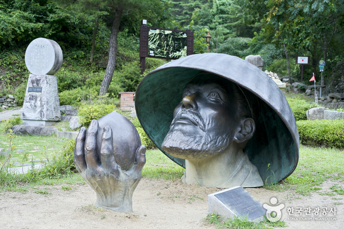
Nango Kim Satgat (1807-1863) was a prominent literary figure who traveled extensively across the Korean Peninsula, leaving behind a rich legacy of literary works. His sobriquet “Satgat” originated from his habitual wearing of a “satgat” (a traditional Korean hat) and his preference for introducing himself by this name. The historic site dedicated to him includes several key features: the house where he once lived, his tomb, a literary museum that showcases his life and works, and a sculpture of the poet.
Sobaeksan National Park (Northern Section) (소백산국립공원(북부))
10.5 Km 28195 2021-06-15
494, Namhangang-ro, Danyang-gun, Chungcheongbuk-do
+82-43-423-0708
Sobaeksan Mountain is renowned for its natural splendor and mystery, standing tall in the middle of the Korean peninsula, and offering several magnificent peaks, such as Hyeongjebong, Sinseonbong, Gungmangbong, Birobong, and Yeonhwabong. Its captivating seasonal beauty attracts visitors year round. The moutain's recreational forest was designated as the third national park in Chungcheongbuk-do in 1987, following Songnisan Mountain and Woraksan Mountain in 1970 and 1984 respectively. The open grass field on Birobong Peak (1,439 meters) resembles the Swiss Alps. On Yeonhwabong Peak (1,349 meters) is Sobaeksan Optical Astromony Observatory (SOAO), which laid the foundation for Korea's astronomy.
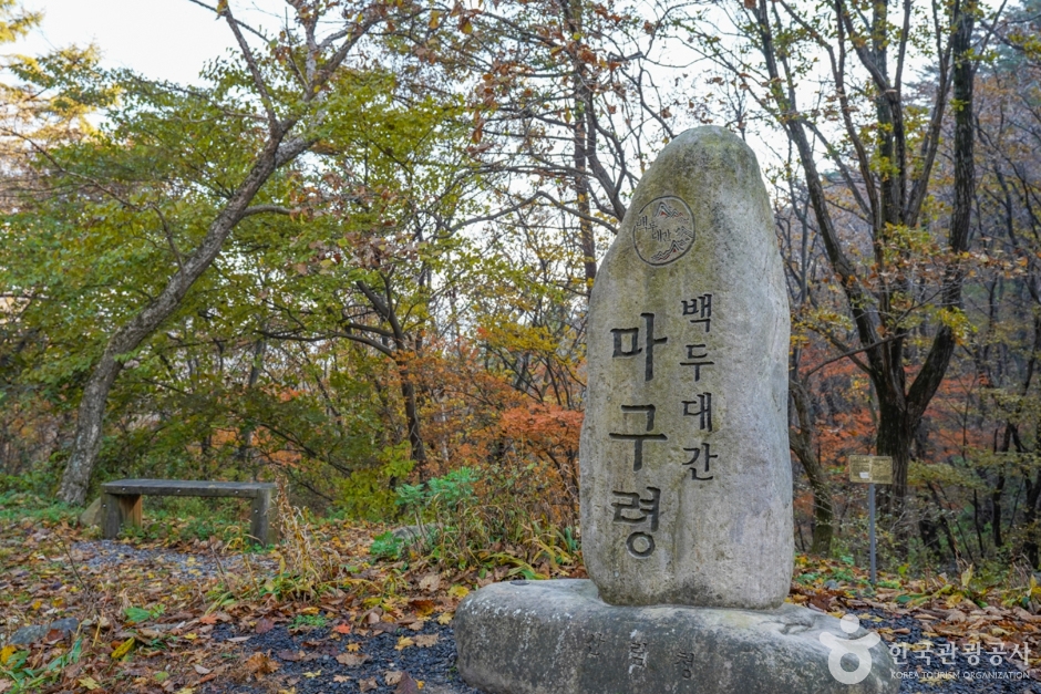
Maguryeong Pass / Gochiryeong Pass (마구령/고치령)
10.5 Km 33668 2024-02-23
[Maguryeong Pass] Imgok-ri, Buseok-myeon, Yeongju-si, Gyeongsangbuk-do
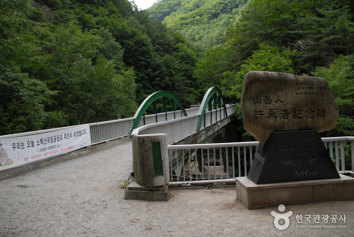
Maguryeong Pass and Gochiryeong Pass stand as iconic hills of Sobaeksan Mountain. They are known for their historical significance as rugged pathways where people and goods traversed during the Goryeo and Joseon dynasties. Situated on the easternmost edge of Sobaeksan Mountain, Maguryeong Pass derives its name from its function: "Magu" meaning "harness" and "Ryeong" meaning "pass" in Korean, highlighting its past as a route where merchants commonly traveled on horseback. Meanwhile, Gochiryeong Pass served as a vital transport link to the Gwandong and Hoseo regions. In the Silla dynasty, this pass was earmarked for palace construction at the base of the hill, which led to its name "Gochiryeong" – "Go" indicating "old", "Chi" representing "hill", and "Ryeong" meaning "pass" in Korean – effectively translating to "old hill pass".
Chosun Minhwa Museum (조선민화박물관)
10.9 Km 37111 2020-05-15
432-10, Gimsatgat-ro, Yeongwol-gun, Gangwon-do
+82-33-375-6100
Chosun Minhwa Museum finished construction in 1998, in Waseok-ri, Gimsatga-myeon, Yeongwol-gun, Gangwon-do and opened on July 29, 2000. The museum contains about 3,000 folk paintings (minhwa) from the Joseon era and is comprised of a hands-on program hall where visitors can paint a minhwa on a wood plate and the chunhwa (obscene painting) exhibition which is eligible for only adults.
In addition to this museum, Gimsatgat Culture Hall and Indian Art Museum are also in Yeongwol.
 English
 한국어
한국어 日本語
日本語 中文(简体)
 Deutsch
 Français
 Español
 Русский