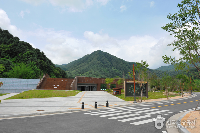
Yeoninsan Provincial Park (연인산도립공원)
19.0Km 2025-01-08
Buk-myeon, Ha-myeon, Gapyeong-eup, Gapyeong-gun, Gyeonggi-do
The source of Yongchu Falls, Mount Yeoninsan (연인산) stands at 1,068 meters above sea level and features soft terrain and beautiful scenery. Local folklore has it that those coming to the mountain wishing for true love will have their dreams come true.
The soil of Mount Yeoninsan is fertile, offering a great natural environment for a variety of flowers and trees. Numerous types of wild flowers thrive from early spring to late autumn. The trail connecting Mount Yeoninsan with mounts Myeongjisan, Cheonggyesan, and Gwimokbong remains relatively unspoiled by human influence: cooking and camping in the area is strictly forbidden. All the mountains in the trail are over 1,000 meters high. A defining feature of Mount Yeoninsan is the royal azaleas that bloom in late May. The County of Gapyeong celebrates the royal azalea by hosting the Mount Yeoninsan (Natural Ecology) Festival in May of each year.
Also ideal for hiking, Mount Yeoninsan offers a number of trails: one starts from Buk-myeon in Baekdun-ri, one from Mail-ri, and one from Yongchu Valley. With a minimum of climbing, hikers can take in a variety of scenic views, ranging from the bloom of the royal azaleas in the spring to the beauty of the changing leaves in the fall.
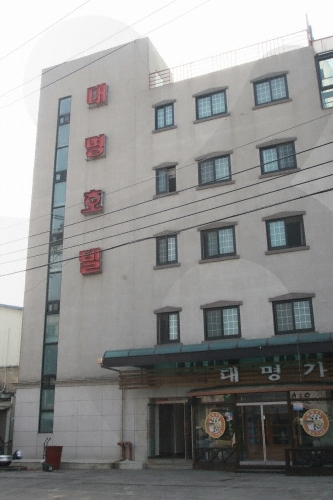
Daemyeong Tourist Hotel (대명관광호텔)
19.1Km 2024-03-20
15 Wasu-ro 181beon-gil, Seo-myeon, Cheorwon-gun, Gangwon-do
Located in Cheorwon, Daemyeong Hotel offers various accommodations, including standard rooms, special rooms, and suites. Each room is equipped with air conditioning, internet access, a refrigerator, toiletries, and a hair dryer. Guests can enjoy free Wi-Fi and Netflix services in their rooms. Additionally, the hotel features a café, a pub, and an internet café for leisure and entertainment. Nearby is the Seungni Observatory, a notable DMZ peace tour site, adding a unique aspect to the stay.
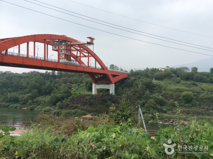
Hantangang Bungee Jump Korea Leisure (한탄강번지점프(코리아레저))
19.4Km 2024-03-20
153 Taebongdaegyo-gil, Galmal-eup, Cheorwon-gun, Gangwon-do
Taebongdaegyo Bridge, towering over the Hantangang River, serves as the starting point for Ice Trekking programs in winter. During the summer, it transforms into a bungee jumping site. The platform, elevated 52 meters above sea level, offers a truly exhilarating drop. This site also provides a spectacular view of the Hantangang River’s beautiful valleys.
![Jiktangpokpo Falls [National Geopark] (직탕폭포 (한탄강 국가지질공원))](http://tong.visitkorea.or.kr/cms/resource/70/1137370_image2_1.jpg)
Jiktangpokpo Falls [National Geopark] (직탕폭포 (한탄강 국가지질공원))
19.9Km 2021-09-25
94, Jiktang-gil, Cheorwon-gun, Gangwon-do
Jiktangpokpo Falls is location in the middle of Hantangang River, which runs through town of Dongsong-eup in Cheorwon. Unlike other falls, Jiktangpokpo Falls is not tall, but wide instead as the 3 meter-high falls stretch almost 60 meters from bank to bank. Widely known for its grandeur and beauty, Jiktangpokpo Falls is one of the 8 scenic wonders of Cheorwon. It is an ideal summer vacation spot and visitors can enjoy the savory maeuntang (spicy seafood stew) made with freshwater fish at one of the many restaurants located in the vicinity.
 English
 한국어
한국어 日本語
日本語 中文(简体)
 Deutsch
 Français
 Español
 Русский