Explanation
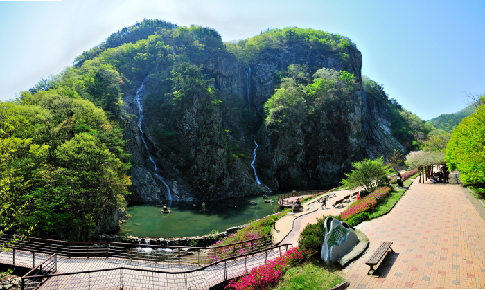
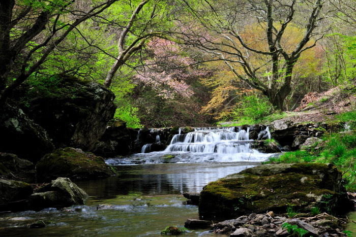
Gangcheonsan Mountain is surrounded by Gwangcheonsan Gwangjubong Peak (583.7 meters above sea level), Gwangdeoksan Seonnyeobong Peak (578 meters), and Sanseongsan Yeondaebong Peak (603 meters above sea level) in the area of 996beonji, Cheonggye-ri, Sunchang-gun, Jeollabuk-do. It is divided into small canyons and has an outstanding view with rocky mountains on all sides. The valley was called Gangcheon Valley because clean and clear water flows like a spring on the hard rocks, and all the mountains around it were called Gangcheonsan Mountain. It is said that in the past it was called Yongcheonsan Mountain, named after the shape of two dragons waving their tails toward the sky and ascending to heaven.
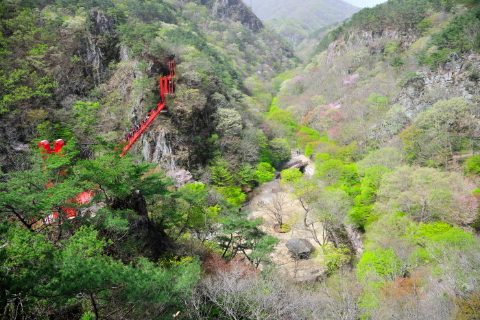
Following the Noryeong Mountain Range to Chuwolsan Mountain, it forms Gwangdeoksan Mountain and Yongcheonsan Mountain. On Sanseongsan Mountain (two dragons from the eastern sky to the western sky) that towers high in the sky, two dragons run east side by side. There are numerous peaks, some famous ones are, Yeondaebong, Undaebong, Suyeongbong, Cheonjabong, Gitdaebong, Gwangjubong, Gyeonjebong, and Songrakbong peaks. Between these two mountains is a very deep valley. Some of the famous valleys are, Yeondaegyegok Valley, Seonnyeogyegok Valley (Jeobujegol), Wondeunggyegok Valley (Yongdaeamgol), Buntonggol Pass, Jijigol Valley, Somokgol Valley, Samindaegyegok Valley (Hwangwoojegol), Giwoojegol Valley, Senyanggol Valley, Multonggol Valley, Chodanggol Valley, Ujakgol Valley, Dongmakgol Valley, Geumganggyegok Valley (Tapsanggol), Seungbanggol Valley, Byeondugol Valley, etc. The clear water flowing from every valley joins into one and the sound of the water crashing against the rocks and stones echoes throughout the valley and enters Gangcheonho Lake.
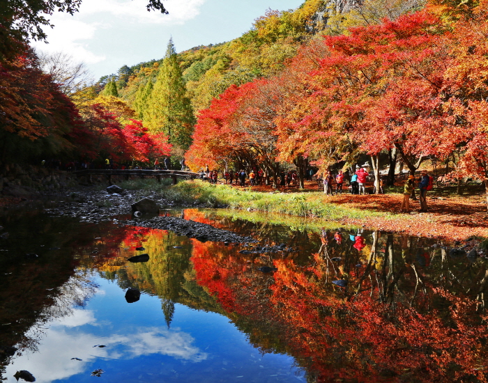
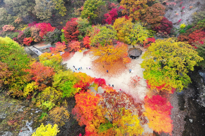
When spring comes, willows bloom, and when the forsythia and azaleas are in full bloom, wild cherry blossoms reach full bloom on every mountain peak. The clear and clean water flows continuously between the gravel along the valley. Visitors can cool off the heat in this river that does not collect moss either because it is too cold or clean. On Gangcheonsan Mountain, there are beautiful shrubs and maple trees, and the baby maples and baby squirrels announce the arrival of autumn among the seven different types of maple trees. The multiple trails on the mountain are not steep or too dangerous, making it popular regardless of age. It is also ideal for mountaineering and mountain-loving hikers. The scenery of the river with white snow and icicles attracts painters who want to capture the moment on a canvas. Gangcheonsan Mountain has four distinct seasons making it a popular destination all year round.
Homepage
Information Use
Contact and Information : • 1330 Travel Hotline: +82-2-1330
(Korean, English, Japanese, Chinese)
• For more info: +82-63-650-1672
Parking facilities : Available
Day off : N/A (Open all year round)
Hours : April-October 08:30-18:30
November-March 09:00-17:00
* Operating hours subject to change depending on the weather condition
More information
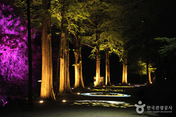
Night-time Hike Restriction Notice
Limited access after sundown
Hiking Course
Barefoot walking trail: Byeongpungpokpo Falls - Gangcheonsa Temple - cloud bridge - Gujanggunpokpo Falls (5.5 km, 2 hr)
Forest walking trail: Byeongpungpokpo Falls - playground - forest village - Hwangujegol Valley - Samindae - ticketing booth (4.7 km, 2 hr)
Healing hiking course: Byeongpungpokpo Falls - Gancheonsa Temple - cloud bridge - observatory - Hwangujegol Valley - Samindae ticketing booth (5.5 km, 2 hr)
Wangjabong course 1: Byeongpungpokpo Falls - Gitdaebong Peak - Wangjabong Peak - cloud bridge - ticketing booth (6.2 km, 3 hr)
Wangjabong course 2: Byeongpungpokpo Falls - Gitdaebong Peak - Wangjabong Peak - Hyeongjebong Peak - second lake - Gujanggunpokpo Falls - ticketing booth (8.7 km, 4 hr)
Wangjabong course 3: Byeongpungpokpo Falls - Gitdaebong Peak - Wangjabong Peak - Hyeongjebong Peak - Songnakbawi Rock - Gujangpokpo Falls - ticketing booth (10.7 km, 5 hr)
Seonnyeobong course 1: Byeongpungpokpo Falls - Okhobong Peak - Hwangujegol Valley - Sinseongbong Peak - cloud bridge - Gangcheonsa Temple - ticketing booth (7.5 km, 3 hr)
Seonnyeobong course 2: Byeongpungpokpo Falls - Okhobong Peak - Hwangujegol Valley - Gwangdeoksan Mountain - Seonnyeogyegok Valley - Gujanggunpokpok Falls - ticketing booth (10 km, 4 hr)
Seonnyeobong course 3: Byeongpungpokpo Falls - Okhobong Peak - Gwangdeoksan Mountain - East gate - Biryongpokpo Falls - Gujanggunpokpo Falls - ticketing booth (12.8 km, 5 hr)
Jungju course: Byeongpungpokpo Falls - Gitdaebong Peak - Wangjabong Peak - Hyeongjebong Peak - Songnakbawi Rock - Sirubong Peak - Gwangdeoksan Mountain - Okhobong Peak - ticketing booth (18.6 km, 8 hr)
Shopping Information
Approx. 20 restaurants, accommodations, convenience stores, etc.
Parking Fees
Free
Admission Fees
[Individual]
Adults 3,000 won / Students 2,000 won
[Groups]
Adults 2,500 won / Students 1,500 won
* Students (elementary, middle, high school)
* Groups: 30 or more people.
* Free admission: Preschoolers (ages 6 & under) and senior citizens (ages 65 and older)
Restrooms
Available
Location
97, Gangcheonsan-gil, Sunchang-gun, Jeonbuk-do


 English
 한국어
한국어 日本語
日本語 中文(简体)
 Deutsch
 Français
 Español
 Русский