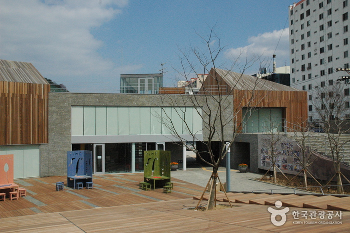
Isang Yun Memorial Park (Docheon Theme Park) (윤이상 기념공원(도천테마파크))
2020-03-18
27, Jungang-ro, Tongyeong-si, Gyeongsangnam-do
+82-55-644-1210
A memorial park for the world-renowned composer Isang Yun was created in Docheon-dong, Tongyeong-si where the great composer was born. The Isang Yun Memorial Park consists of several sections including an exhibition hall displaying the composer’s legacy; a multi-purpose lounge, serving coffee and selling souvenirs; a Memorial Hall, where all kinds of performances and seminars take place; and Gyeongsa Square, an outdoor event venue.
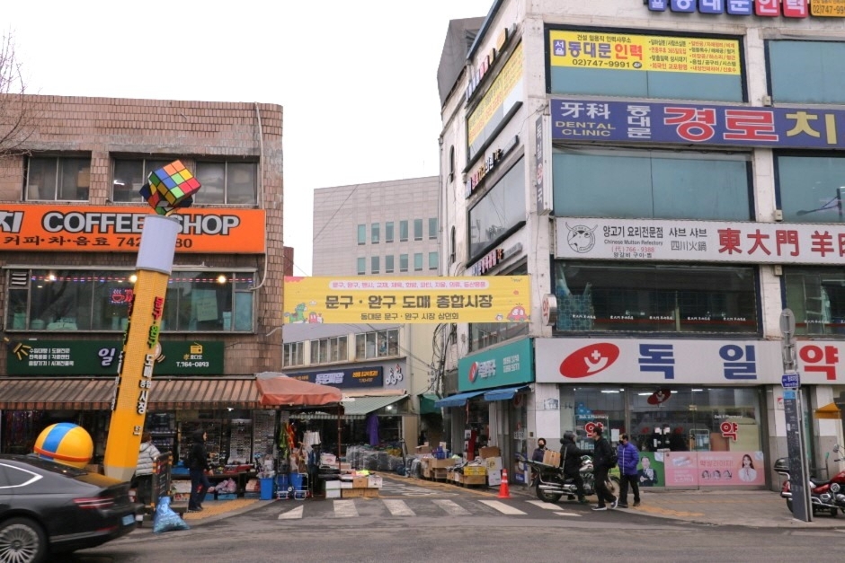
Dongdaemun Stationery Store Street (동대문 문구완구거리)
2024-03-15
21-1, Jong-ro 52-gil, Jongno-gu, Seoul
+82-2-1330
Dongdaemun Stationery Store Street houses nearly 120 stores selling stationery products like notebooks, crayons, pencils, backpacks, as well as other products like children’s gifts, decorations, and party products. Products can be found at prices nearly 30 to 40% lower than the consumer products, which can be lowered even further when buying in bulk. Products past the season may see the prices drop by more than half.
Mongolia Culture Town (몽골문화촌)
2021-01-29
1635, Biryong-ro, Namyangju-si, Gyeonggi-do
+82-31-559-8018
Established upon the signing of a friendship pact between the city of Namyangju and the Mongolian capital city of Ulaanbaatar, Mongol Cultural Village is a unique place in Korea where visitors can experience the traditional culture of Mongolia.Inside the exhibition hall, about 800 items from Mongolia including traditional clothes, instrument and household goods are on display.
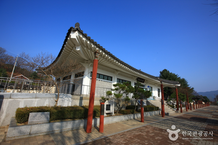
Dasan Heritage Site (Namyangju) (다산유적지 (남양주))
2023-06-27
11, Dasan-ro 747beon-gil, Joan-myeon, Namyangju-si, Gyeonggi-do
+82-31-590-2837
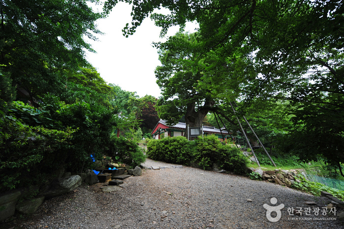
Dasan Heritage Site is located in the hometown of Dasan Jeong Yak-Yong (1762~1836), a scholar from the late Joseon Dynasty. Growing up in the village, Dasan criticized corruption, and tried to reform outdated institutions and conventions. During his long exile, Dasan authored "Mongminsimseo" (a book on how to rule the people) and "Gyeongseyupo" (a book on how to reform land policies, stabilize people's lives, and strengthen the nation and its army) among others. Today, Dasan is regarded as one of the greatest scholars of Silhak (Realist school of Confucianism) of the late Joseon dynasty.
At Dasan Heritage Site, Dasan's birthplace, Yeoyudang, grave and works are well preserved. Dasan Memorial showcases the scholar's achievements and footprints such as Geojunggi, a traditional equipment used to lift heavy objects in the Suwon Fortress construction, and the miniature Gangjin Dasan Chodang, where he lived in exile. Dasan Cultural Center houses Dasan's numerous writings and books.
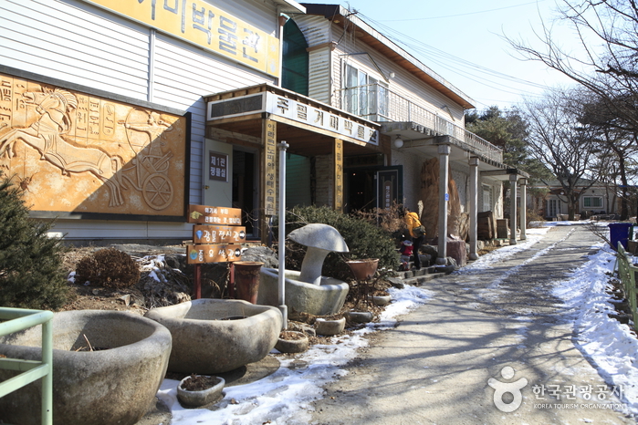
Arachnopia Ecological Arboretum (JooPil Spider Museum) (아라크노피아 생태수목원·주필거미박물관)
2021-06-18
316, Ungilsan-ro, Namyangju-si, Gyeonggi-do
+82-31-576-7908
The JooPil Spider Museum was founded on September 1, 1985 by Dr. Kim Ju-pil, who traveled around the world to collect and study spiders. The museum aims to be a fundamental education center for students by offering them various hands-on scientific activities. The main building has a collection of spiders and insects from around the world. The annex exhibits rare minerals from around the world as well as microscopes to show the dissection of spiders. The museum has a total of approximately 220,000 spider samples from more than 5,000 species.
Incheon Yonggungsa Temple (용궁사 (인천))
2021-11-12
199-1, Unnam-ro, Jung-gu, Incheon
+82-32-746-1361
Yonggungsa Temple is located in the same region as the Incheon International Airport and sits on the northeastern slopes of Baegunsan Mountain. During the Silla Kingdom (about 1,300 years ago), the temple was named ‘Baegunsa’ by King Munmu, in reference to the temple’s mountain home. During the Joseon dynasty, it was the temporary residence of Heungseon Daewongun (1820-1898, a politician and father of King Gojong), who stayed at the temple for 10 years praying for his son to ascend to the throne. When his son was finally crowned king, Heungseon Daewongun rebuilt the temple and changed the name to Yonggungsa.
The temple consists of various buildings such as Gwaneumjeon (re-constructed by Heungseon Daewongun), Yosachae (home of the monks), Chilseonggak, and Yonghwanggak. In Yosachae, the writings of Heungseon Daewongun are hung on the wall and recently, an 11 meter-high statue of Maitreya was put in place. In front of the temple are two 1,300 year-old zelkova trees.
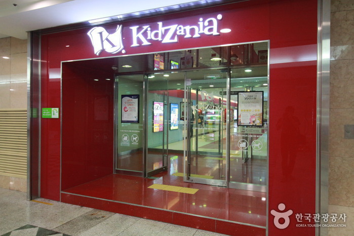
KidZania Seoul (키자니아 서울)
2024-03-13
240, Olympic-ro, Songpa-gu, Seoul
+82-1544-5110
KidZania is a theme park organized around the idea of vocational experience for children. It is home to a variety of facilities where one can experience different career paths, all located on a scale model of a city. Visitors can learn what it is like to work as a firefighter, doctor, cook, member of the police force, reporter, and more.
Deoksan Hot Spa District (덕산온천지구)
2020-05-27
Deoksan-myeon, Yesan-gun, Chungcheongnam-do
+82-41-339-7303
Deoksan Hot Spa is conveniently in Sadong-ri, Deoksan-myeon, Yesan-gun, Chungcheongnam-do, only one and a half hours away from Seoul. The spa resort’s hot springs have been known for their efficacy ever since the Joseon dynasty (1932-1910) and the 45℃ germanium water is widely known for its health benefits. The region has been home to major spa resorts since 1917.
Nearby tourist attractions include Chunguisa Temple, which enshrines the spirit of Patriot Yun Bong-Gil, and Sudeoksa Temple, a training site for Buddhist nuns. Within the spa district are 9 major spa facilities, approximately 50 hotels, and numerous restaurants.
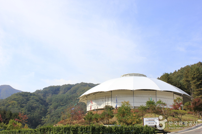
Yecheon Astro-Space Center (예천천문우주센터)
2021-12-23
1078, Chunghyo-ro, Yecheon-gun, Gyeongsangbuk-do
+82-54-654-1710
Yecheon Astro-Space Center is a theme park that opened in November 2004. The Yecheon Astronomical Science and Culture Center has built and operated the Yecheon Star Observatory. Visitors can stay in the accommodations in the park, observe the distant universe through a large telescope, and experience the space environment such as weightlessness.
In the observation room, visitors can observe the appearance of the universe with a 508 mm (20 inch) reflecting telescope that is automatically controlled by a computer. In the auxiliary observation room, visitors can observe sunspots and huge pillars of fire on the surface of the sun with a quadruple solar telescope. The astronomical projection room is a 'space theater' where a digital astronomical projector and video projector are installed, and images related to the astronomical universe, including seasonal constellations, are screened on a hemispherical dome screen on the ceiling.
At the Yecheon Star Observatory, visitors can observe the pillars of fire that soar through the sun during the day and sunspots that are larger than Earth. At night, visitors can observe the galaxy, the nebula, where stars born and die, as well as star clusters, and the moon, which is the closest celestial body to Earth, has large and small meteorite craterson the surface. There are many more fun experiences at the Yecheon Star Observatory.

Songam Space Center (송암스페이스센터)
2019-11-26
103, Gwonnyul-ro 185beon-gil, Yangju-si, Gyeonggi-do
+82-31-894-6000
Songam Space Center, set against the gorgeous backdrop of nearby Jangheung Park, Yangju-si, Gyeonggi-do, is one of the largest space themed parks in Korea. Situated on Gyeomyeongsan Mountain at around 440 meters above the sea level, the observatory (B1-3F) features a main telescope that was locally developed and allows visitors to see the stars even during the day. The observatory is part of Stars Valley, which consists of three different buildings: the Space Center, Star House, and Songam Observatory.
Newton Center, a main observatory center of Songsam Observatory has a 600 milimeter Ritchey-Chretien reflecting telescope allowing for clear and convenient observation of the stars. Galilei Center, a sub-observatory facility has seven telescopes including reflecting, catadioptric and refracting telescopes, as well as a CCD camera, digital camera, intermediate telescope and other observation aid devices. Facilities at the observatory include the Challenger Learning Center, a Digital Planetarium, and Star House, a four-story accommodation/training facility. There are also two cable cars, each of which can hold as many as 33 people.
 English
 한국어
한국어 日本語
日本語 中文(简体)
 Deutsch
 Français
 Español
 Русский