
Healing Stay Kosmos [Korea Quality] / 힐링 스테이 코스모스 리조트 [한국관광 품질인증]
0m 816 2022-01-01
88-13, Chusan-gil, Ulleung-gun, Gyeongsangbuk-do
Healing Stay Kosmos is located at the edge of a cliff next to Songgotsan Mountain in Ulleungdo Island. The exterior is in a spiral shape, reflecting the trajectories of the sun and moon. The six-vault structure, which extends outward in a spiral shape from the center of the building, is the most essential element—each of the vaults form an independent space inside. Due to the spiral shapes, the entrance to the vaults temporarily blocks the landscape outside; however, as the guest enters further into the vault, the view to the surrounding landscape gradually opens up, and each vault reveals a unique view. This allows every guest to naturally immerse themselves into the hotel’s beautiful architecture and the surrounding landscape. The hotel also observes strict hygiene and disinfection to ensure the safety and convenience of guests. The maintains the cleanliness of every room and bedding every day. To prevent the spread of COVID-19, the hotel staff regularly ventilate and disinfect all facilities and a designated disinfection and quarantine manager strictly monitors the staff’s compliance with the social distancing manual. The hotel also provides a complimentary healing kit, which includes a hand sanitizer (as well as a trekking map and specialty snacks from Ulleongdo Island), to all guests.
![Elephant Rock [Ulleungdo-Dokdo National Geopark] (코끼리바위 (울릉도, 독도 국가지질공원))](http://tong.visitkorea.or.kr/cms/resource/79/2499379_image2_1.jpg)
Elephant Rock [Ulleungdo-Dokdo National Geopark] (코끼리바위 (울릉도, 독도 국가지질공원))
1.1 Km 11214 2024-02-23
Hyeonpo-ri, Buk-myeon, Ulleung-gun, Gyeongsangbuk-do
+82-54-790-6182
Elephant Rock is situated approximately 500 meters off the northern coast of Ulleungdo Island and rises to a x_height of 50 meters. It derives its name from its remarkable resemblance to an elephant. This distinctive formation resulted from lava solidifying after a volcanic eruption, with the unique gap between what appears to be the elephant's trunk and its body sculpted over time by the relentless action of the waves.
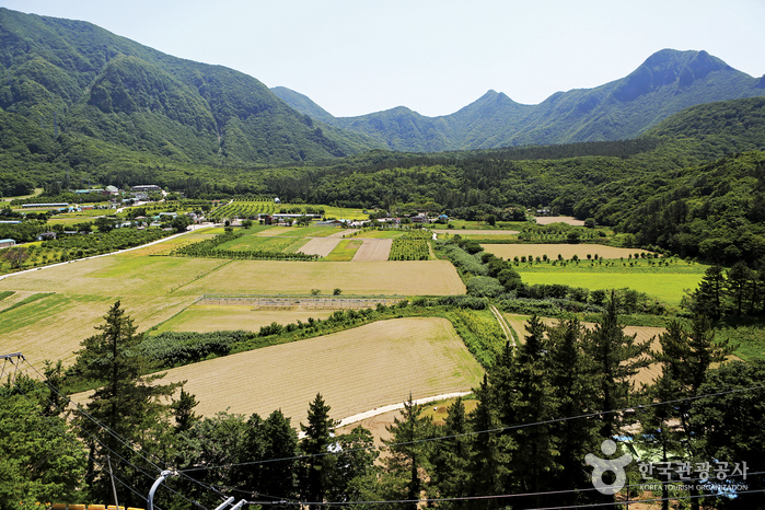
Nari Basin (나리분지)
1.6 Km 13184 2021-05-13
Nari-gil, Ulleung-gun, Gyeongsangbuk-do
+82-54-790-6423
Originally a caldera formed on the northern Seonginbong Peak, Nari Basin is the only flatland on Ulleungdo Island. The lava flow from the volcanic eruption created two other craters, which were turned into Nari Village in the northeast and Albong Village, now uninhabited, in the northwest. Records were found that the island was inhabited since the Usan-guk period, but the islanders had to move out of the island in the earlier Joseon period until a new settlement policy was enforced later on.
Jugam Pebble Beach [National Geopark] (죽암 몽돌해안 (울릉도, 독도 국가지질공원))
1.7 Km 9205 2022-08-03
3140 , Ulleungsunhwan-ro, Ulleung-gun, Gyeongsangbuk-do
+82-54-790-6394
Jugam Pebble Beach, located on Ulleungdo Island, is approximatly 500 meters long and 20 meters wide and has round pebbles weathered by the fierce waves. The rough rock and basalt are swept back and forth by strong waves, creating round pebbles.
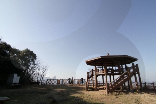
Seokpo Observatory (석포전망대)
4.0 Km 6107 2020-03-24
Cheonbu-ri, Ulleung-gun, Gyeongsangbuk-do
+82-54-790-6392
Seokpo Observatory is located in Seokpo village, a small fishing town at the northernmost point of Buk-myeon on Ulleungdo Island.
Ulleungdo Island has three popular scenic lookouts, one of which is Seokpo Observatory to the north. Created in 1905, the observatory was used by the Japanese through 1945 to monitor movements of Russian warships.
Seokpo Observatory offers views of the East Sea between Ulleungdo and the Korean Peninsula. The observatory has an 8-sided pavilion with lookout deck and telescope from which views of picturesque Jukdo and the majestic coastline of Buk-myeon are available. The area is also nearby the 3 popular attractions of Gongam (an elephant-shaped rock), Gwaneumdo, and Samseonam. Below the observatory is Seokpo Resting Area and a trekking course connecting Seokpo Observatory and Naesujeon Sunrise Observatory.
![Bongnaepokpo Falls [Ullengdo & Dokdo National Geopark] (봉래폭포 (울릉도, 독도 국가지질공원))](http://tong.visitkorea.or.kr/cms/resource/28/1893628_image2_1.jpg)
Bongnaepokpo Falls [Ullengdo & Dokdo National Geopark] (봉래폭포 (울릉도, 독도 국가지질공원))
4.5 Km 13284 2024-02-23
Dodong-ri, Ulleung-eup, Ulleung-gun, Gyeongsangbuk-do
+82-54-790-6182
Nestled within the picturesque mountains of eastern Ulleungdo Island, Bongnaepokpo Falls stands as a majestic 30-meter high waterfall. Its formation traces back to the cooling of rocks following a volcanic eruption. This lush region is richly wooded, offering a delightful opportunity for a forest bathing during your hike. Moreover, the deck situated just beneath the waterfall serves as an ideal spot for capturing stunning photographs. Even in the heat of summer, the area remains pleasantly cool, thanks to the gentle breeze that naturally flows through the openings.
![Samseonam Rocks [National Geopark] (삼선암 (울릉도, 독도 국가지질공원))](http://tong.visitkorea.or.kr/cms/resource/77/2745577_image2_1.jpg)
Samseonam Rocks [National Geopark] (삼선암 (울릉도, 독도 국가지질공원))
4.8 Km 0 2023-10-10
Cheonbu-ri, Buk-myeon, Ulleung-gun, Gyeongsangbuk-do
Samseonam Rocks is comprised of three rock pillars off the northern coast of beautiful Ulleungdo Island. The sea stacks were formed by waves breaking down a block of columner joints over time, leaving the three remaing stacks behind. The sides of the stacks are dotted with many holes, resembling honeycomb. The rocks name, meaning "Three Hevenly Maiden Rocks," comes from a myth that three heavenly maidens were so enraptured by the beauty of Ulleungdo that they missed their curfew to return to heaven and were thereby punished by being turned to stone.
![Seonginbong Primeval Forest [National Geopark] (성인봉 원시림 (울릉도, 독도 국가지질공원))](http://tong.visitkorea.or.kr/cms/resource/57/2370057_image2_1.jpg)
Seonginbong Primeval Forest [National Geopark] (성인봉 원시림 (울릉도, 독도 국가지질공원))
4.9 Km 10938 2021-04-23
Namyang-ri, Ulleung-gun, Gyeongsangbuk-do
+82-54-790-6182
The foot of Seonginbong Peak is covered with thick primeval forests designated as Natural Monument No. 189. This forest is Ulleungdo Island's only flat area with a diameter of approximately 2 kilometers. It is a caldera formed by volcanic activities and developed over time. The area has many rare plants only found in Ulleungdo Island.
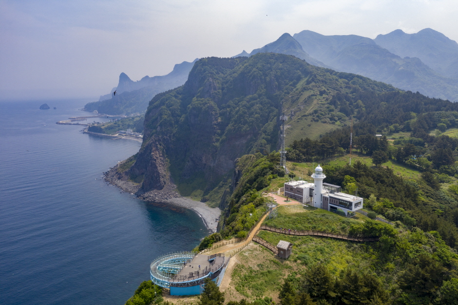
Taeha Coastal Trail and Daepunggam Cliff (태하 해안산책로 및 대풍감 (울릉도, 독도 국가지질공원))
5.1 Km 0 2024-03-29
Taeha-ri, Seo-myeon, Ulleung-gun, Gyeongsangbuk-do
Taeha Coastal Trail can be reached by crossing the pedastrian bridge next to Hwangtogul Cave. While crossing the bridge, visitors can enjoy murals of Taeha Village and a photo zone. Taeha Coastal Trail is made up of trachyte and agglomerate rocks, and boasts beautiful coastal scenery due to the unique topography eroded by the wind. It is also where one can observe tafoni, a honeycomb-shaped rocks that weathered by the reaction of salts contained in sea breezes.
By taking the Taeha Hyangmok Tour Monorail for about 6 minutes and walking along the trail for about 20 minutes, visitors will reach Ulleungdo Lighthouse (Taeha Lighthouse) and the Hyangmok Geo Skywalk.
Junipers in Daepunggam Cliff grew in weathered soil formed in the cracks of columnar joints, creating a unique ecological environment isolated from inland areas for a very long time. Due to its significance, Junipers were designated as natural monuments.
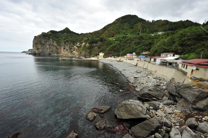
Hakpo Coast (학포해안 (울릉도, 독도 국가지질공원))
5.7 Km 0 2024-03-29
166-29 Hakpo-gil, Seo-myeon, Ulleung-gun, Gyeongsangbuk-do
Hakpo is known for its beautiful coast as well as the remains that record the frontier history of Ulleungdo Island. There are agglomerate, tuff, and trachyte layers along the Hakpo Coast. The relatively hard trachyte layer that cannot be eroded by waves and remains has formed a cape (a large piece of land sticking out into the sea), while the agglomerate and tuff layers, which are subject to weathering and erosion, have formed a bay. Additionally, sea cliffs are found along the coast. As the lower part of the vertical columnar joints erodes, the upper part of the cliff collapses due to gravity, creating a steep cliff as the process is repeated. Visitors can also enjoy the atmosphere of Hakpo at the nearby Hakpo Campground.
 English
 한국어
한국어 日本語
日本語 中文(简体)
 Deutsch
 Français
 Español
 Русский