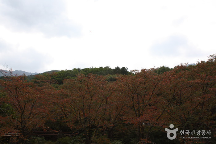
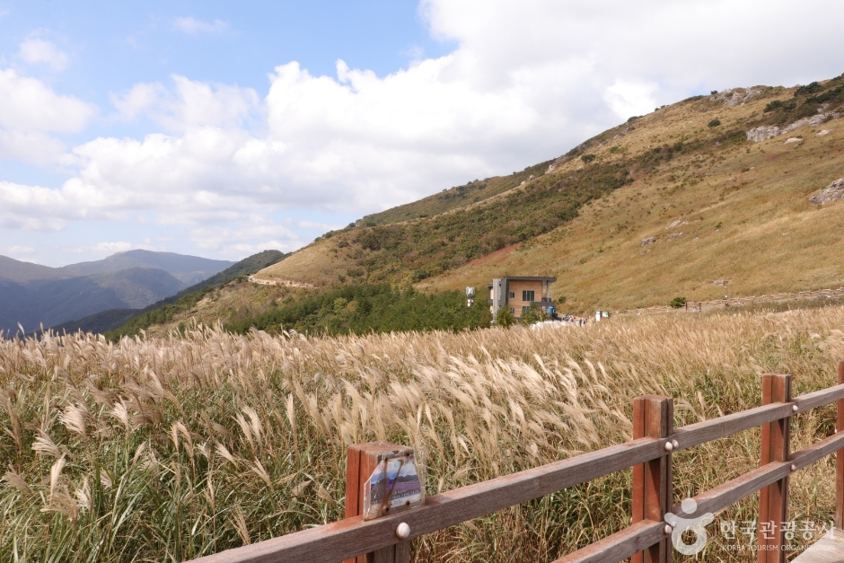
Sinbulsan County Park (신불산군립공원)
11.4Km 2021-06-30
Sangbuk-myeon, Ulju-gun, Ulsan
+82-52-229-7882
Sinbulsan County Park is located in parts of the Sangbuk and Samnam districts of Ulju County. The massive area encompasses 11.66 square kilometers and is home to one of the most impressive peaks in the Yeongnam Mountain Range found in the southeast of Korea. The park’s hiking trails interconnect with those of neighboring Gangwolsan and Yeongchwisan Mountains and attract a large number of hikers year-round.
Near the peak of Silbulsan Mountain sits a fortress with breathtaking views of silver grass. Water starts high above the clouds at Danjobong Peak and trickles down through streams and waterfalls to join the deep mountain valleys. One of the better known attractions in Silbulsan Mountain is Hongnyupokpo Falls which offers impressive views from its gentle cliffs.
Also nearby the mountain are Deungeok Hot Springs and a number of restaurants for hikers to visit and enjoy after a full day on the mountain.

The Oriental Medicine Resort: Chorakdang (한방테마파크 초락당)
11.6Km 2025-01-07
44-34, Gyemyeong-ro, Ulju-gun, Ulsan
+82-52-264-8001
Opened in 2001, Chorakdang is a health resort that specializes in Oriental medicine treatments. The resort offers the perfect setting for rest, relaxation, and medical treatments. The traditional hanok buildings and natural surroundings intensify the health benefits of the resort.
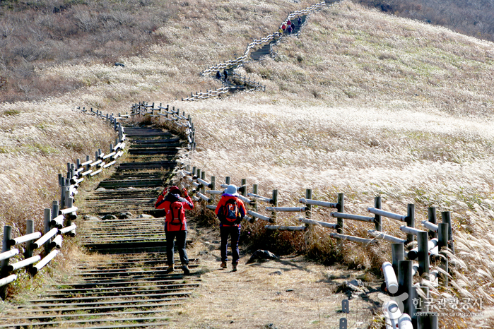
Ganwolsan Mountain (간월산)
12.3Km 2021-06-30
614, Ganwolsan-gil, Ulju-gun, Ulsan
+82-52-277-0101
Ganwolsan Mountain is a popular destination for hikers in the Ulsan and Busan area as well as other regions of Gyeongsangnam-do. In early August, the reeds and lilies near the summit create a splendid view. To the west, the deep Naerijeong and Wangbonggol Valleys channel clean water to Baenaegol Pass.
From the Ganwolgogae Pass, hikers can follow the Singal Path to Wanbonggol Pass towards Paraeso Falls. There, visitors will find a cave called Jungnimgul, which is sacred Catholic ground often visited by the Catholic faithful. The first church built by Catholics in the Yeongnam region to escape persecution is found in Buldanggol Pass in Ganwolsan Mountain area. The tomb of Kim Agatha who died in persecution is also in the Ganwolgol Valley.
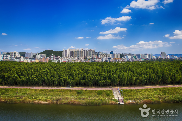
The Taehwagang National Garden and Simni Bamboo Grove (Milky Way Trail) (태화강 국가정원 십리대숲 (은하수길))
12.6Km 2025-08-06
5 Saetgangnam-gil, Jung-gu, Ulsan
Simni Bamboo Grove is a bamboo forest that stretches over about 4 kilometers along the Taehwagang River and is a natural garden using bamboo that has grown naturally for a long time. It is a healing space in the city where the river wind blowing through the bamboo and the whisper of bamboo leaves tickle one's ears. It's also a unique night garden where the Milky Way descends in the dark, hence its name "Milky Way Trail." It is a must-see course where you can feel as if you are walking along the Milky Way in the night sky as colorful lights meet bamboo.
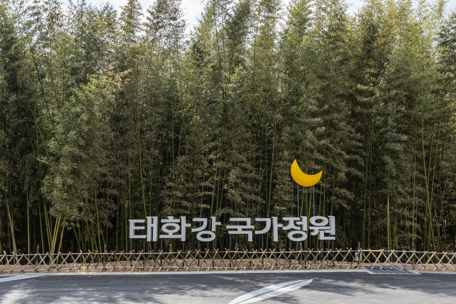
Taehwagang National Garden (태화강 국가정원)
12.6Km 2025-10-23
154 Taehwaganggukgajeongwon-gil, Jung-gu, Ulsan
The Taehwagang River cuts across the heart of Ulsan and flows into Ulsan Bay, which is connected to the East Sea. The river basin, which stretches 36 kilometers from east to west and 28 kilometers from north to south, is mostly comprised of mountainous terrain, but there is fertile land on both sides of the river and at the southern end of the river. The river is presently an important source of drinking water for the citizens of Ulsan.
The field around the midpoint of Taehwagang River was left abandoned for a long time before it was founded as Taehwagang National Garden, preserving nature while providing a resting spot to the citizens of Ulsan. The garden is over twice the size of Yeouido Park in Seoul, and consists of natural water and a lush bamboo forest, known as Simnidae Forest, along with canola and forage barley fields. Simnidae Forest was once in danger of demolition as part of the government's flood control plans but remains preserved thanks to community efforts. Preservation efforts led to turning the area into Taehwagang National Garden of today, which was recognized as Korea's second national garden in 2019.
◎ Travel information to meet Hallyu’s charm - TV series"Death's Game"
This is the place that Yee-jae, reborn as his mother, visited to remember his mother by. There are six thematic gardens along the Taehwagang River, all beautiful in their own unique ways. The view created a strong contrast with Yee-jae’s sad expression, creating a memorably tragic scene.
Twelve Scenic Places of Ulsan City (울산 12경)
12.7Km 2024-02-20
Ulsan Metropolitan City
Twelve Scenic Places of Ulsan City encompass the stunning landscapes of Ulsan, showcasing the natural beauty and cultural richness of the region. These include the bamboo forest in Taehwagang Gardens, the majestic rock formations in Daewangam Park set against the backdrop of the azure sea, the four seasons of Gajisan Mountain, the silver grass field of Sinbulsan Mountain, the breathtaking sunrise at Cape Ganjeolgot, the ancient Petroglyphs of Bangudae Terrace and Cheonjeon-ri from the Neolithic era. Other scenic spots include the Gangdong and Jujeon Pebble Beach, Ulsan Grand Park, the captivating night view from the Ulsandaegyo Bridge Observatory, the charming Jangsaengpo Whale Culture Village, the serene Oegosan Onggi Village, and the picturesque Naewonam Valley in Daeunsan Mountain.

Sunmot Ecological Park (숯못 생태공원)
13.1Km 2022-08-18
90 , Hamwol-ro, Jung-gu, Ulsan
+82-52-290-3691
Sunmot Ecological Park is home to the famous Sunmot Pond, which is associated with the legend of Dongbangsak and Grandmother Mago. The pond provides a beautiful resting space in the heart of Ulsan.
Olive Young - Ulsan Okdong Branch [Tax Refund Shop] (올리브영 울산옥동점)
13.4Km 2024-06-27
1F, 336, Munsu-ro, Nam-gu, Ulsan
-
![Artbox - Ulsan Okdong Branch [Tax Refund Shop] (아트박스 울산옥동점)](http://tong.visitkorea.or.kr/cms/resource/77/3314077_image2_1.jpg)
Artbox - Ulsan Okdong Branch [Tax Refund Shop] (아트박스 울산옥동점)
13.4Km 2024-06-27
339, Munsu-ro, Nam-gu, Ulsan
-
Taehwagang Donggulpia (태화강동굴피아)
13.7Km 2024-02-20
306 Namsan-ro, Nam-gu, Ulsan
Taehwagang Donggulpia has transformed several artificial caves created by the Japanese military during the Japanese colonial period into a tourist attraction, originally intended for storing military supplies. Visitors can catch a glimpse of Ulsan's history and way of life during that era. Outside the caves, there is an artificial falls, and inside, various experiential zones such as the Cave Adventure Zone, Digital Sketch Experience Zone, and Lighting Art Zone offer diverse interactive experiences.
 English
 한국어
한국어 日本語
日本語 中文(简体)
 Deutsch
 Français
 Español
 Русский