![Homeplus - Jakjeon Branch [Tax Refund Shop] (홈플러스 작전)](http://tong.visitkorea.or.kr/cms/resource/09/2882409_image2_1.jpg)
Homeplus - Jakjeon Branch [Tax Refund Shop] (홈플러스 작전)
15.1Km 2024-04-23
27, Gyeyang-daero, Gyeyang-gu, Incheon
-
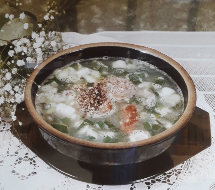
Yangssine Wangsundae (양씨네왕순대)
15.2Km 2021-03-19
131, Wonjong-ro, Bucheon-si, Gyeonggi-do
+82-32-682-1170
This is a Korean cuisine located in Bucheon-si, Gyeonggi-do. The representative menu is blood sausage soup. It is located near the Gogang Prehistory Relics Park (Tourist Site).
National Institute of Biological Resources (국립생물자원관)
15.2Km 2023-04-13
42, Hwangyeong-ro, Seo-gu, Incheon
+82-32-590-7000
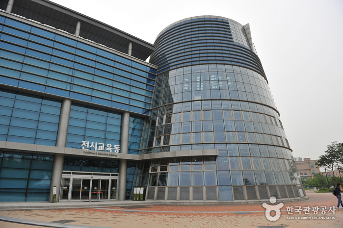
Opened in October 2007, the National Institute of Biological Resources is the largest collection preservation facility in Northeast Asia. The institute collects, preserves, manages, and conducts research on biological resources with the aim of growing into a focal biological resource hub of Northeast Asia. The institute is comprised of a spine-shaped collections and research center and a leaf-shaped exhibition and education center. The exhibition hall has 3,905 specimens of 1,287 native species on display. Korea's diverse ecosystems are recreated as highly detailed dioramas at the exhibition hall. A small restaurant is located inside the research center, and the extensive grass field in front of the institute provides an ideal picnic spot.
![Olive Young - Yeomchang Station Branch [Tax Refund Shop] (올리브영 염창역)](http://tong.visitkorea.or.kr/cms/resource/93/2880093_image2_1.jpg)
Olive Young - Yeomchang Station Branch [Tax Refund Shop] (올리브영 염창역)
15.2Km 2024-04-22
#102, and #103, 637, Gonghang-daero, Gangseo-gu, Seoul
-
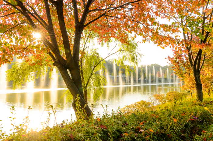
Seoseoul Lake Park (서서울호수공원)
15.2Km 2022-10-19
20, Nambusunhwan-ro 64-gil, Yangcheon-gu, Seoul
+82-2-2604-3004
Covering over 225,000 ㎡ of land in the southwestern part of Seoul, Seoseoul Lake Park, also known as West Lake Park, was to resolve the regional imbalance in the city. The park is a eco-friendly park designed with the themes of "water" and "recycling." Before turning into a park, the area was used as a purification plant that produced approximately 120,000 tons of tap water to Seoul. The park has a children's playground, sports facilities like the soccer field, basketball court and badminton courts, and a cultural plaza. With its vast space and 24-hour operation, the park provides a relaxing ground for the citizens of Seoul.
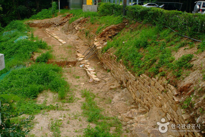
Odusanseong Fortress (파주 오두산성)
15.3Km 2024-12-03
Seongdong-ri, Paju-si, Gyeonggi-do
Odusanseong Fortress is built around the strategic summit of Odusasn Mountain. The walls stretch across roughly 620 meters and were built during the Baekje dynasty. The fortress is built on the intersection of the Imjingang River and the Hangang River on the summit of Odusan Mountain (119 meters). The mountain’s slope is steep and stones used in the construction of the fortress walls are scattered here and there at the summit. These scattered stones are evidence that the fortress underwent repairs several times during the Samguk (Three Kingdoms) era and the Joseon dynasty, as these stones were evidently quarried and used to mend the fortress walls. Excavations have discovered a great deal of earthenware, white porcelain, tile, and iron arrowheads. Topographically, the fortress sits on a prime strategic junction and the Unification Observatory has been situated there as well. The fortress stands as an important object of study concerning fortifications and structures from the Baekje dynasty. It has been recorded on the stele of King Gwanggaeto, Samguksagi (History of the Three Kingdoms), in the Naekjebongi (Baekje Annals) and on Daedongyeojido (Map of Korea) that the fortress was the Gwanmi Fortress of Baekje, attracting many scholars and researchers interested in this period.

World Cup Park (월드컵공원)
15.3Km 2024-10-23
243-60 World Cup-ro, Mapo-gu, Seoul
Opened on May 1st, 2002, the Wolrd Cup Park was once a 15-year-old landfill that held over 92 million tons of garbage. The park is located near Seoul World Cup Stadium, and is made up of five smaller parks - Pyeonghwa (Peace) Park, Haneul (Sky) Park, Noeul (Sunset) Park, Nanjicheon Park, and Nanji Hangang Park.
* Pyeonghwa Park: Closest to Seoul World Cup Stadium, it holds a pond, garden, children’s playground, and forest. As a representative park of World Cup Park, the park was designed in hopes of peace and harmony between mankind and nature. It is often used as a picnic area and place for nature studies.
* Nanji Hangang Park: Nanji Hangang Park was developed on the banks of the Hangang River. In contrast to other Hangang River parks, Nanji Hangang Park is a water-friendly park that has a gradual slope towards the riverbank. The park consists of a camping ground, soccer field, basketball court, grass field, cruise ship port, and an area for nature studies.
* Haneul Park: Haneul Park consists of vast grassland located at the highest elevation of the five parks. The park's pasture is covered with eulalias and wild flowers in their most natural state. In addition, 30,000 butterflies of different species were introduced in 2000 to stabilize the ecosystem. Five wind-powered generators provide power to the park and the park’s maintenance office. Once a mountain of garbage, it is now a green hill with 22 lookout points offering breathtaking views of Seoul, including the N Seoul Tower, Bukhansan Mountain, and Hangang River. Tall trees are line the park to provide shades and serve as resting spots for visitors. As a popular spot to enjoy the sight of eulalias, the park usually remains open until late in the evening during the Eulalia Festival period.
* Noeul Park: In order to prevent the vast area of land of what was once a wasteland from becoming an unnecessary chunk of land, a nine-hole golf course was constructed in what is now known as Noeul Park. The golf course serves as an environment friendly entertainment park to visitors while stabilizing the geographical formation and has an urban park nearby that offers scenic views of the Hangang River and beautiful sunset. Located west of the golf park is Noeul Square, decorated with shrubs and flowers.
* Nanjicheon Park: Nanjicheon Park was developed from the Nanji Stream, which flowed under Haneul Park. It was once overflowing with sewage runoff from a nearby landfill, but it has since been beautifully restored into a park with clear water. The park is built to serve as a recreational spot for those with for youths, elders, and people with disabilities.
Bucheon U-ri General Hospital (부천우리병원)
15.3Km 2025-07-29
(Wonjong-dong), 726 Sosa-ro, Ojeong-gu, Bucheon-si, Gyeonggi-do
Bucheon U-RI General Hospital is a general hospital with an advanced medical system that is in line with the rapidly changing medical environment. The hospital won “excellent” ratings across all health checkup areas and in the Accreditation Program for Healthcare Organizations by the Ministry of Health and Welfare. With outstanding medical staff, ambitious investments in hospital facilities, and ceaseless training, we continue to grow. We maintain specialized centers across various fields, including the Gastroenterology Center, Spine & Joint Center, and the Cerebral Neurology Center, and our medical departments include internal medicine, neurology, orthopedics, spine surgery, general surgery, urology, gynecology, and dentistry. We also offer an integrated nursing care service that allows patients to be admitted without a caregiver. Our Comprehensive Health Checkup Center operates on 1,652 ㎡ under agreements with numerous public institutions and businesses. Checkup visitors can receive an early diagnosis of diseases and follow-up care from each medical department. Our strengths not only include its high-end medical facilities but also its convenient location near Incheon and Gimpo Airports. We will continue to expand our infrastructure to offer the best experience for overseas patients who want to benefit from Korea’s outstanding medical services.
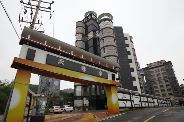
Picaso Hotel (피카소호텔)
15.4Km 2020-03-19
34, Seongdong-ro, Paju-si, Gyeonggi-do
+82-31-947-5512
Located in Tanhyeon-myeon of Paju-si in Gyeonggi-do, Picaso Hotel is a nine-story building with rooms of various themes. The fresh air and gorgeous scenery helps draw in guests. The nearby Heyri Village is another attraction, as well as Paju English Village, Tongildongsan and Provence Village. Breakfast is free the restaurant and the hotel is also equipped with a large parking lot capable of accomodating large groups.
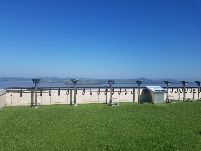
Odusan Unification Observatory (오두산 통일전망대)
15.4Km 2024-12-03
369 Pilseung-ro, Paju-si, Gyeonggi-do
+82-31-956-9600
Located in Tanhyeon-myeon, Paju-si, Odusan Unification Observatory was established to console the feelings of dispersed families and provide an educational site for the unification education through 5F to B1 in 1992.
The observatory is situated in the northernmost ceasefire line of the western front where the Hangang River and Imjingang River meet. It offers a wide view of Songaksan Mountain in Gaeseong to the north and 63 Building in Seoul to the south. Also, it is a valuable unification security tourist attraction related to Imjingak, the 3rd Tunnel, and Panmunjeom (Joint Security Area) stretching along Jayu-ro Road in the northeast.
Since its opening, almost 1,900,000 people have visited the observatory to feel the reality of the division, making this area the best national unification education site.
 English
 한국어
한국어 日本語
日本語 中文(简体)
 Deutsch
 Français
 Español
 Русский